
Less than an hour outside of Oaxaca de Juárez sits a hiking, biking, and cabin or camping adventure tucked inside of an amazing pine and oak tree forest landscape. Whether you want to get away for a quick afternoon visit or stay overnight in the quaint cabins or camping areas, the Ecotourism Park at Santa Catarina Ixtepeji is worth checking out.
I’ve been lucky enough to spend a lot of time in this area, and I’ve personally visited, hiked, and stayed at this park. And I’m here to give you the details you need to visit Ixtepeji. After reading this easy-to-follow post, you’ll have all you need to know to check it out.
Disclosure: If you purchase through links on this page, we may earn a commission at no extra cost to you. This helps support this content.

Getting Out of Town and Going to Ixtepeji
Santa Catarina Ixtepeji is a small town and municipality located less than 30 miles (~45 km) northwest of the city.
This area is one of the closest mountain areas to the most popular tourist area and has limited development. On the way up, just minutes outside the city, you’re greeted with a beautiful pine tree filled forest with exceptional views overlooking the city itself.
The road gets a little steep almost instantly, with some switchbacks and superb views. But it’s actually pretty easy going and in great shape.
You’ll find a handful of restaurants and shops along the way on Highway 175. Many of which offer outdoor tables tucked in the trees, overlooking the rolling mountains to the city below.
If you keep driving up, there’s a little hot spot of shops and restaurants in a spot known as Las Animas. You can find hand-carved wooden utensils, locally grown fruit and vegetables, as well as other artisan crafts. And the municipal area of Ixtepeji itself sits about 1 mile northwest off of 175 just after Las Animas.
But the Ecopark is well before Las Animas and the actual municipal area of Ixtepeji.
Where Is the Ecotourism Park of La Cumbre Ixtepeji?
Ixtepeji has a large ecotourism park with trails, cabins, and camping, and that’s the focus of this article. It goes by a few different names, including:
- La Cumbre Ixtepeji
- Ecoturístico Comunitaria Park
- Centro Ecoturístico La Cumbre Ixtepeji
- Ixtepeji Park
To reach La Cumbre Ixtepeji, you’ll need to drive or catch a ride about an hour away from the heart of Oaxaca de Juarez (20 miles or 33 km). You’ll first stop at the Ixtepeji Park office on the main road, 175. This is where you pay the modest entry fee, which as of fall 2023 was $50 pesos per person for a day visit.
Then you’ll drive up a dirt road to reach the trails and main area. This road is well grated and easily drivable in any vehicle. But it is a little steep and might be somewhat slick in rainy or wet weather.
Why Should You Go to La Cumbre Ixtepeji?
There are a few main attractions in this beautiful park. They range from the relaxing to the extreme. Some are good for the whole family, others are only for those who want to push the limits.
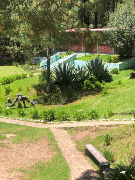
You can go sightseeing, birdwatching, hiking, or mountain biking. There are beautiful little cabins for overnight stays as well as designated camping areas with covered grilling picnic areas.
There’s also a restaurant onsite, along with a basketball court, children’s play areas, multiple swings, and a good size event center.
Relax and See the Views and Watch the Birds
If you simply want to get out of the city and breathe fresh air, Ixtepeji is a great spot for that. The drive up is well worth it, especially because it’s so close to the city. The road itself has plenty of great views and cuts right through the forest filled with large pine trees.
Once you get to the turnoff for the park, you can drive 1.4 miles (2.2 km) to the first lookout point, known as Mirador La Magueyera. This is basically right off the dirt road, a very short hike up about two staircases to a stunning overlook. Perfect for the whole family to get a great view without putting in much effort.
If you continue driving about another 1.5 miles (2.4 km), you’ll come to the main trail intersection known as El Cerezo (the cherry tree) where the hiking and biking trails start.
Traveler tip: The word for “trail” in Spanish is “sendero.”
This is also where a bird watching area is located, marked “avisitar aves” on the map, which means “to visit birds.” You can also go birdwatching from both lookout points (miradores) and find birds throughout the entire park area.
Drive on to find the main cabins, restaurant, and camping area. This is 4.2 miles (6.8 km) off the main road 175 from the front office. This central area to the La Cumbre Ixtepeji Park sits at about 9,500 feet (2,900 m) in altitude.
You can take a hiking trail from here or keep driving to the main lookout point, Mirado Pelado Chiquito, which is at about 10,400 feet (3,170 m) in elevation.
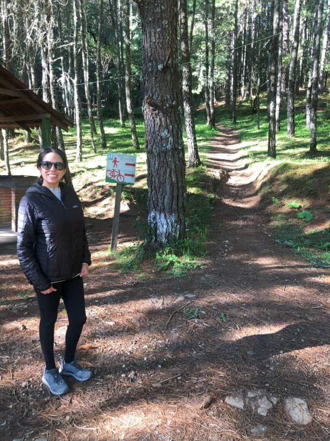
The Trails: Hiking and Biking
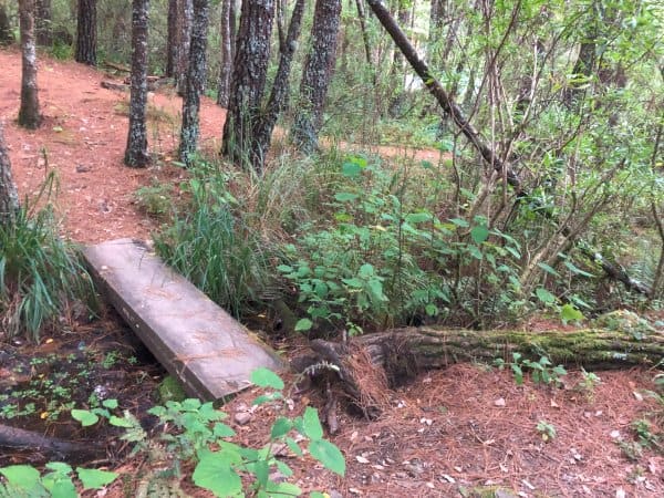
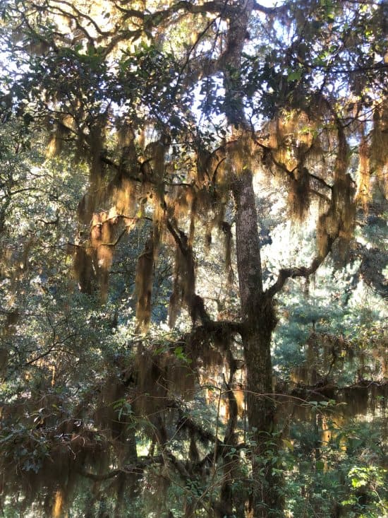
There is a network of biking and hiking trails throughout the La Cumbre Ixtepeji Park. The lower elevations have a stunning mossy landscape filled with small waterways, giant oak trees, tons of flowers, and other bushes. The ground is hard with lots of pine needles and rocks just below the surface.
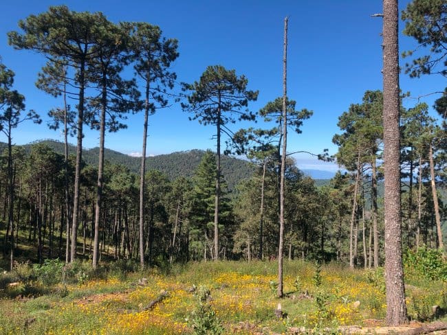
Higher elevations are a little drier with tall pine trees and less moss, but a lot of grasses and still plenty of wildflowers.
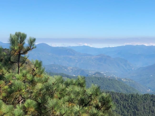
Your reward for reaching the higher spots is worth it. Downright incredible panoramic views of the surrounding mountains and forests. You can even spot some of the other great spots nearby, including San Agustin Etla and some of the communities in Sierra Norte.
The map available is a little rudimentary, but here’s the general idea of the layout.
If you want to do the shortest hike but still see the lookout points, you can reach both Mirador La Magueyera and Mirador Pelado Chiquito by car. You’ll have to hike about 500 yards (450 m) from the parking area near the top to the Mirado Pelado Chiquito.
I enjoyed the hike from the cabins and camping area up to Mirador Pelado Chiquito. It is about 1.8 miles (3 km) in each direction, or 3.7 miles (6 km) in total. The elevation gain is somewhat substantial at around 1,800 feet (550 m). It took me about 2 hours to go there and back at a very gentle pace.
To get to this trail, go up the road to the cabins by the basketball court and then stay to the left. You’ll see some older mountain biking jumps and a line of abandoned restrooms. Continue straight up that trail, crossing twice over the road before reaching the mirador lookout point.
It starts along the river with mossy oak trees and large bushes. Then it opens up to thin pines at the top with more simple grasses and wildflowers. The mirador is a great ending point with amazing views. It’s a wooden structure with staircases reaching about two stories off the ground.

You can also hike from El Cerezo up the trail known as Cabeza de Vaca (head of the cow). This will be about double the length and eventually leads to the Mirado Pelado Chiquito as well.
There are a few different ways you can turn off Cabeza de Vaca and head to the cabins and camping area. And you can decide to take the road or the trail once you meet the road (blue on the map). Based on the AllTrails user tracks, there are a few other circular routes ranging from around 5 to 7 miles (8 to 11 km).
For more information about the hiking trails, there are a handful of reports on AllTrials.com.

If you’re mountain biking, the spot people seem to start from the most is the Cabeza de Vaca trail. From El Cereze (near the Avistar Aves), you’re at a high point in the park and can simply stay to the left and continue to Mirador Pelado Chiquito.
You can choose to head back on the same route or take the downhill option straight to the cabin area. This has some areas with large drops (4-5 feet or about 1.5 m), but there are easy ways around all of them. It is a pretty good downhill track though where you’ll either have plenty of speed or will get your brakes warm.
TrailForks.com has a lot of information about the biking trails in this area for those interested in trying out their own routes.
Overnight Cabins and Camping
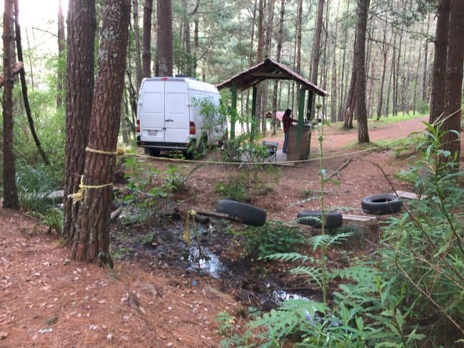
One of my favorite parts of going here was staying overnight. You can camp in a tent or RV or rent nice cabins.
We have a decked out campervan, so we opted for the simple camping sites. They basically allow you to pitch a tent or park your small RV wherever you like, but there are about 8 different covered grilling spots they recommend staying by. They have metal roofs and concrete tables with built-in charcoal grills.
The cost in late 2023 for two of us to camp overnight was just $100 pesos, plus the entrance fee of $50 pesos per person. There is a bathroom with flushing toilets, showers, and sinks. There are also trash cans onsite.
There are also quite a few cabins to stay overnight in. There are nine cabins made of adobe with fireplaces. They are simply adorable. And also quite affordable at $600 for up to 2 people and $250 for each extra person. There is space for 32 people in total, in case you are considering a group outing.
El Campamento Restaurante is in the same area as the cabins and camping. It can seat up to 50 people. So you don’t even have to bring up your own food if you don’t want to. It was open for lunch and dinner while we were there, but I believe that hours can be somewhat irregular.
I really enjoyed staying overnight. The temperatures are much cooler than the city, so it was a great place to cool down. It was also quite empty when we went, so it was like camping in a remote spot. We could see plenty of stars, enjoy the fresh mountain air, and get fully recharged before heading back to the busier areas down the mountain.

The Many Ways to Get There
The first place you need to make your way to is the office right off of 175. On Google Maps, this is marked as Ecoturístico Comunitaria de Santa Catarina Ixtepeji Park. Once you pay the entrance fee (and for camping or cabins, if desired), you’ll then head northwest on the dirt road. The main cabin area is on Google Maps as Centro Ecoturístico La Cumbre Ixtepeji.
Here are the precise directions for confirmation:
- Head east out of the city on Highway 190 to Monumento Benito Juárez
- Hang a left (north) on 175
- Drive for 13 miles (20.5 km) to the main office
- Turn off onto the unnamed dirt road heading northwest
- Drive for 4 miles (less than 7 km) on the dirt road to get to the main cabin area
We love renting a car for excursions in Mexico and have driven extensively in and around Oaxaca. We recommend making a reservation through Discover Cars.
If you don’t want to rent a car, you can hire a private taxi. They are the yellow colored ones. To find an estimate of the current rate, you can use the app called Didi. This is essentially the Uber for Oaxaca, but it’s only serviced by licensed taxis. You can pay with cash or card.
You can also catch public transportation. The red and white taxis are colectivos (collective or shared taxis). You can catch them from the “Laa-Yetzi” site located near the Juárez Monument. Ask them to let you depart at the summit or Centro Ecoturístico La Cumbre Ixtepeji.
Once again, this will get you to the base of the dirt road, so you might have to grab another ride from a friendly face heading in or walk the rest of the way. It is about 4.2 miles (6.8 km) from the office on the main road (175) to the main cabin area.
Visiting Ixtepeji With Others
I love going off on my own, but sometimes having a group and guide can be very helpful. This network of trails and area can be a little difficult to navigate, so if you prefer, you can find great tours.
Coyote Tours is a great option for many different adventure tours around Oaxaca. They have an office in the city and a solid reputation for giving reliable tours to the best adventure areas, including hiking and mountain biking.
For hiking near Oaxaca in La Cumbre Ixtepeji, the Full Day Guided Tour in the Enchanted Forest of Ixtepeji is the best option. You’ll meet at their office in the city around 8am to make your way up to the mountain.
Then you’ll have a light breakfast before heading out on the hike up to the top mirador. The guide will help you identify and understand local flora and fauna, before heading back down to the city.
The biking tours visit different areas in Oaxaca, including Ixtepeji and other areas of the Sierra Norte mountains. You can reserve a Coyote Tours Mountain Biking Tour on Viator, called the MTB Enduro at Oaxaca’s Legendary Trails Tour.
You can also hire guides from the local area. Call ahead at (951) 560 4039 to see if you can get information on availability as that fluctuates with the seasons and crowds.
Wrap Up
In less than an hour from the city, you can be surrounded in lush oak and pine tree forests in Ixtepeji. Drive directly to high lookout points or hike the trails and get your heart racing. Enjoy the scenery in slow motion or hop on the seat of a mountain bike for adrenaline-filled fun.
Want to take it slower and stay overnight? Bring up your camping gear or rent a quaint cabin for a roaring fire. The amenities at La Cumbre Ixtepeji are lovely with plenty to do for the whole family.